-
Notifications
You must be signed in to change notification settings - Fork 98
New issue
Have a question about this project? Sign up for a free GitHub account to open an issue and contact its maintainers and the community.
By clicking “Sign up for GitHub”, you agree to our terms of service and privacy statement. We’ll occasionally send you account related emails.
Already on GitHub? Sign in to your account
Strange LIDAR returns for various robots #888
Comments
|
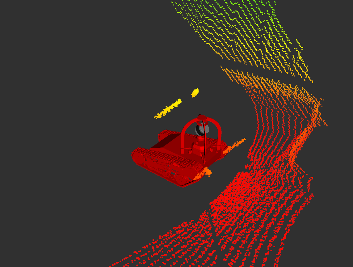
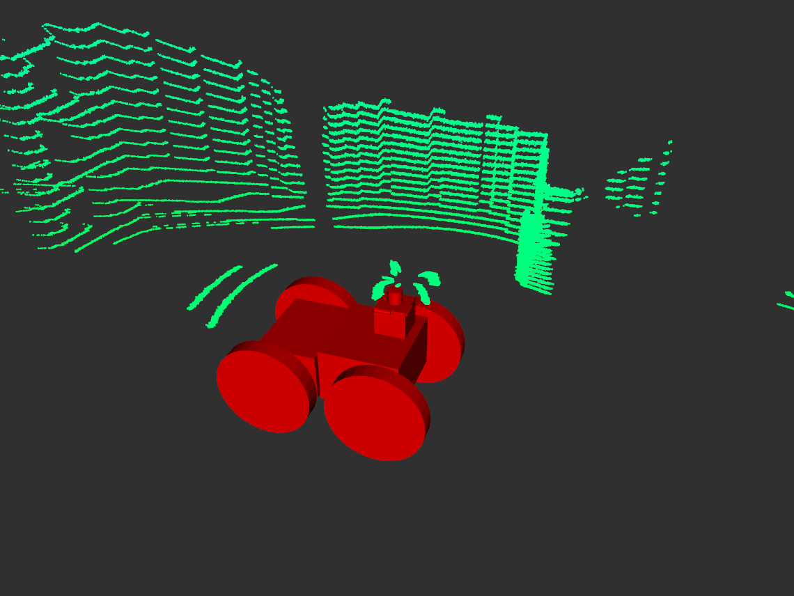
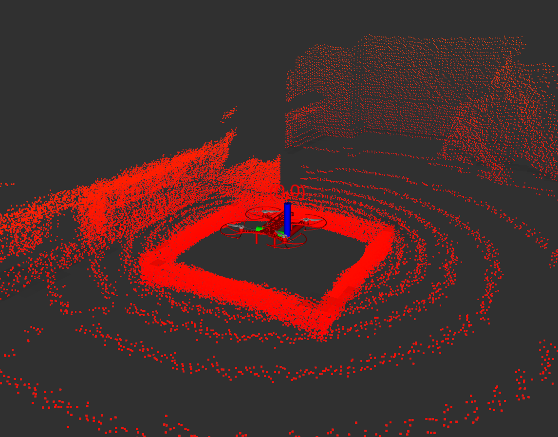
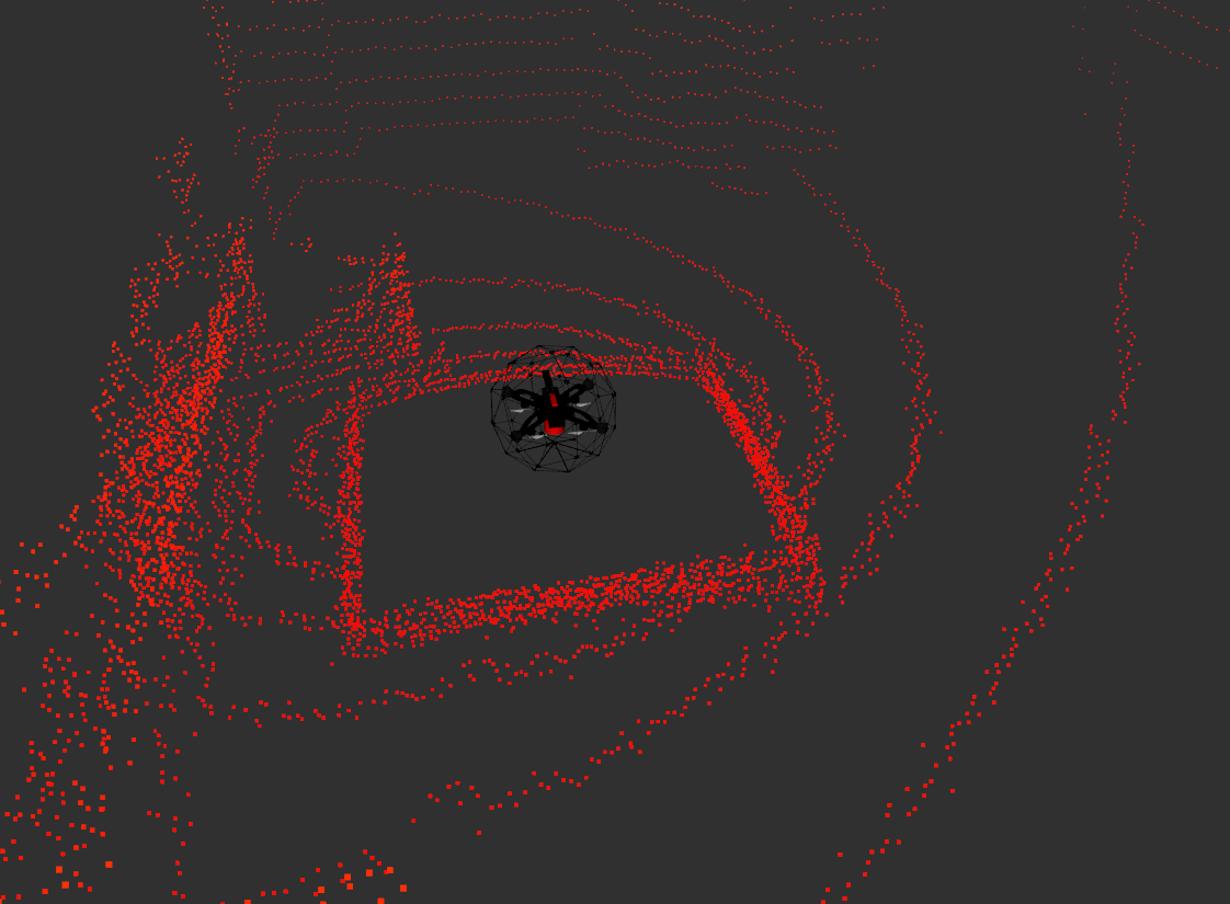
The boxes seen in the gagarin and qav500 are effect of the min range associated with the laser sensors, which are currently set at 0.8 meters. The returns for EXPLORER_R2 match the robot model in simulation. The robot description seen in rviz is not an accurate reflection of the physical robot. The strange returns for CSIRO_DATA61_DTR are also related to a min range of 0.3 meters. |
|
Is the minimum distance using L1 norm then? I would expect default distance vectors to form a spherical pattern and not a box. |
|
I left out an important piece of information. The lidar is simulated using a camera with cube maps. We set the camera near clip distance to the laser minimum range. The effect is the box pattern you see. A fix would require changing the internal camera implementation to use a smaller near-clip and then clip the ranges after the GPU rendering process. |
|
Can't it at least partly be caused by gazebosim/gz-sensors#128 ? This is CTU_CRAS_NORLAB_SPOT_SENSOR_CONFIG_1: Robot parallel with world axes: Robot about 30° to world: Robot 45° to world: Yellow points mark those closer than 0.2 m from the sensor. |
|
Ahh, some of the problems here could actually be consequences of gazebosim/gz-sensors#131 . Mitigation should be simple - just crop the pointcloud 1 cm after min range and 1 cm before max range. |
|
created gazebosim/gz-rendering#356 to fix the incorrect near clip plane issue. Here are the point clouds that I get with the above robots. The lidar points now form a spherical pattern at the bottom and incorrect points that don't correspond to any robot geometry are gone. |


Looking through some of the robots, I've noticed that the LIDAR returns are sometimes wonky, typically but not always if part of the scan intersects robot geometry. I haven't exhaustively checked them all but below are a few for which it is particularly noticeable. For the UGV's the self intersecting scan is somehow displaced from the actual robot geometry, and for the UAV's there is a weird box shaped thing going on.
CSIRO_DATA61_DTR

EXPLORER_R2

MARBLE_QAV500:

CERBERUS_Gagarin:

The text was updated successfully, but these errors were encountered: