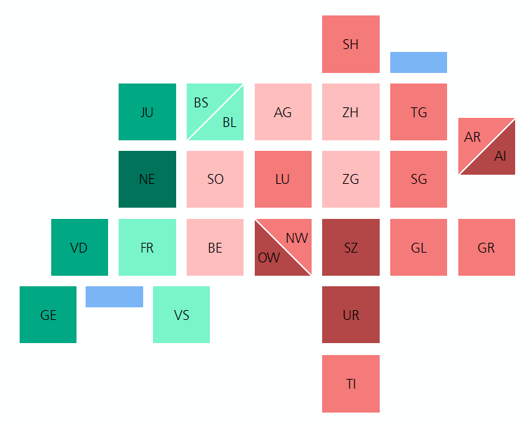
This repository contains a square tilemap of the cantons and half-cantons of Switzerland. This is roughly based on ideas in http://blog.apps.npr.org/2015/05/11/hex-tile-maps.html and in http://aftertheflood.co/projects/london-squared-map.
As of 02.2021, the tilemap is available as an official Datawrapper basemap. Upon creating a new map in Datawrapper, simply select "Choropleth Map", then look for "Switzerland > Cantons (square)". See also Weekly Chart: A tilemap of Switzerland cantons – with some twists.
This repository contains everything you need to make these:
Please feel free to use all resources in this repository. The only thing to do: Please include a note saying "Tilemap CC-BY www.ebp.ch". Thank you.
The data folder contains the data behind the tilemap in GeoJSON (geo-web-native), Shapefile (not great, but most broadly usable industry 'standard'), and SVG (web-native) formats. The tilemap depicting regularly spaced and gridded squares (and half-squares) the data should not generally be re-projected. E.g., the tilemap file in Swiss projection does show squares when drawn, e.g., in a GIS. But if you reproject it to WGS 1984 and look at it, the squares won't be squares anymore. Thus, every projection system available below is its own product, not simply a reprojection.
GeoJSON files are always in WGS 1984 (EPSG:4326), since that is what the standard requires. However, the different GeoJSON files are made for displaying a regular (non-skewed, undistorted) tilemap in different spatial reference systems such as Web Mercator. The following files are available:
- data for display in Web Mercator (EPSG:3857 / SR-ORG:7483) ...
- data for display in Natural Earth Projection (cf.) ...
- ... as GeoJSON file (WGS 1984, EPSG:4326). Use this file in e.g. Datawrapper and choose "Natural Earth" projection for the tiles to display as regularly spaced squares. Update: As of 02.2021, the tilemap is available as an official Datawrapper basemap. Upon creating a new map in Datawrapper, simply select "Choropleth Map", then look for "Switzerland > Cantons (square)". See also Weekly Chart: A tilemap of Switzerland cantons – with some twists.
- ... as Shapefile, for use in desktop GIS or web mapping frameworks with custom projections
- data for display in CH1903+ LV95 (EPSG:2056) as Shapefile, for use in desktop GIS or web mapping frameworks with custom projections
- data for display in CH1903 LV03 (EPSG:21781, a deprecated spatial reference system) as Shapefile, for use in desktop GIS or web mapping frameworks with custom projections
- data as SVG file
Additional material:
- Example ArcGIS 10.3+ project illustrating the use of the shapefiles
- Example graphics
For more infos see: http://www.geo.ebp.ch/2016/01/07/tilemap-der-schweiz (German) or http://www.ralphstraumann.ch/blog/2016/01/switzerland-tile-map (English).


